Monday 27 February 2017

FEBRUARY 2017 : GUERILLA BAY, NSW : Burrewarra Point Walk : 1.3 kms - 50 mins


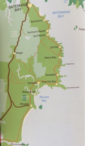
A mild day today with the forecast of possible rain, so rather than heading to the beach for a swim, we decided to a headland 10 mins drive north of Broulee - Burrewarra Point, seen here in the distance.


An easy walk with glorious views of the coastline and through an amazing banksia forest.


Sand paths all over the headland.


Noisy wattle birds flying in and out of the banksia and bottlebrush bushes.


A concrete bunker, which housed power generators during World War 11. Burrewarra Point was used for submarine surveillance and housed a RAAF radar base and hospital.


View north to Malua Bay.


A seal basking on the rocks


The small solar- powered light tower, which beams out over our local beaches.


A Meadow Argus butterfly


Huge Banksia trees cover the path.


The fruit of the Banksia. Known as Banksia Men from May Gibbs classic Snugglepot and Cuddlepie stories.


Standing on the edge of Burrewarra Point.


The view south to Broulee


Near the carpark a vibrant flowering gum.


The tiny Green Wandering Jew plant.


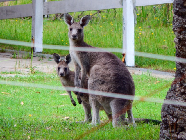
Eastern Grey kangaroos grazing on local lawns.

M
27/2/2017

Saturday 25 February 2017

FEBRUARY 2017 : CANBERRA : Kambah Pool to Tuggeranong Stone BoundaryWall - 14 kms - 4 hours


A walk with the Brindabella Bushwalking Club fro Kambah Pool to the Tuggeranong Stone Boundary Wall. We walked easterly along the well-marked walking track for 7kms to Pine Island and the historical wall, where we had morning tea. There are good views of the Murrumbidgee River and the Red Rocks gorge. There was a 250-300m climb over the distance.


Only a few minutes off the Tuggeranong Parkway is a minor road to Kambah Pool with views of the Bullen Range.


We met in a shady grove of eucalypts before heading off into the heat.


Not far along the path we had the first views of Red Rock Gorge and the Murrumbidgee River.


A male Fairy Wren. They were flitting in and out of the rocks at the base of the gorge.
(Courtesy of the Internet)


The path was well-marked and most of it was very exposed on such a hot day - temperatures in the mid-30s.


The 25 walkers spread out along the path, walking at their own speed. Some more affected by the heat than others.


Red Rock Gorge - the red rocks that give it its name. Quite spectacular at sunrise apparently.


Not much wildlife out in the heat today but we did catch a glimpse of a large Eastern Grey kangaroo.


Views towards Tidbinbilla Mountain.


Part of the Bicentennial National Trail that moves through the Snowy Mountains and down into southern Victoria.


Views through to the Gorge along the trail.


A break at the half-way point at the Tuggeranong Boundary Wall. It was built between 1867-1875 as a boundary between two major properties of Lanyon and Yarralumla. It was built in traditional English style without mortar.


Rest and break on the dry stone boundary wall.


Crossing the Murrumbidgee on our return.


Back at the car park and some walkers decided to have a swim in Kambah Pool before returning home.


The only bit of colour today was a Native Bluebell as I was getting into the car.

Very satisfying walk despite the heat. I look forward to walking it again maybe in Spring.

M
FEBRUARY 2017 : CANBERRA : Mt Mugga Nature Reserve through Isaac Pines to Fadden - 13 kms - 4 hours


A very pleasant 13 kms walk from Hindmarsh Drive, through Mt Mugga Nature Reserve, along the spine of Isaac Pines then through the Wanniassa Hill Nature Reserve to Fadden. All part of the Centenary Trail.


We met on the corner of Mugga Lane and Hindmarsh Drive.


An enthusiastic group, a little surprised by the 19o temperature after many weeks of oppressive heat.


We set off on the well-marked track. Very dry and brown after such a dry summer - the hottest in Canberra's history.


Almost from the start excellent views. This is to the west looking over Woden Valley to the Brindabellas.


To the north looking over Central Canberra. 


Mt Mugga Nature Park


A bit of a diversion as we travel cross country, having missed the Mt Mugga summit.


Across a plain used for horse agistment and equestrian training.


Walking towards the suburb of Isaacs along a walkway.


Isaac Ridge through pine forests.


Mt Sheaffe Trig (793m)


Mt Mugga gravel quarry


Discussing signposts and best way to exit Isaac Pines reserve


Not much wildlife in the pine forest, apart from a few magpies...and this realistic kookaburra adorning a local garden.


Walking out of Isaacs Pines Reserve to Long Gully Road.


Under an underpass to link to Wanniassa Nature Reserve.


Kangaroos grazing.


Only another 3 kms to the suburb of Fadden where we'd left cars for the return journey.
M